File:DRAFT HALEStorm UAV Global Reach.png
Jump to navigation
Jump to search

Size of this preview: 800 × 448 pixels. Other resolution: 1,746 × 978 pixels.
Original file (1,746 × 978 pixels, file size: 2.03 MB, MIME type: image/png)
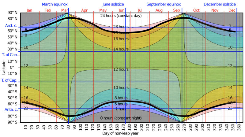
Graph of daylight hours as a function of season and latitude, with capabilities overlayed for each HALE aircraft in this roadmap. This graphic was adapted from SebastianHelm's graphic found at https://en.wikipedia.org/wiki/Sunrise_equation#/media/File:Hours_of_daylight_vs_latitude_vs_day_of_year_with_tropical_and_polar_circles.svg
File history
Click on a date/time to view the file as it appeared at that time.
| Date/Time | Thumbnail | Dimensions | User | Comment | |
|---|---|---|---|---|---|
| current | 20:42, 2 December 2020 | | 1,746 × 978 (2.03 MB) | Kuny (talk | contribs) |
You cannot overwrite this file.
File usage
There are no pages that use this file.