Difference between revisions of "File:HALEStorm UAV Global Seasonal Capability.png"
Jump to navigation
Jump to search
(No difference)
|
Latest revision as of 13:06, 3 December 2020
Global and seasonal capability of the HALE UAV, mapped over daylight hours as a function of season (x-axis) and latitude (y-axis)
File history
Click on a date/time to view the file as it appeared at that time.
| Date/Time | Thumbnail | Dimensions | User | Comment | |
|---|---|---|---|---|---|
| current | 13:06, 3 December 2020 | 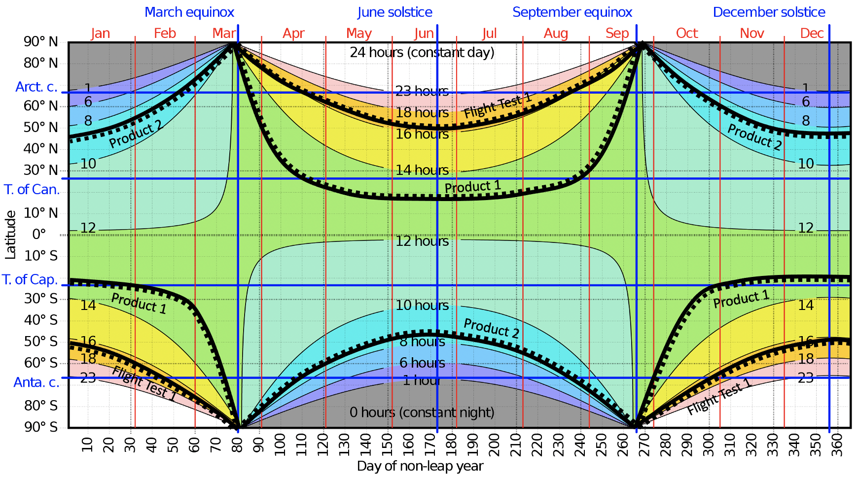 | 1,742 × 970 (1.57 MB) | Kuny (talk | contribs) |
You cannot overwrite this file.
File usage
The following page uses this file: