File:Satellite-constellation.png
Jump to navigation
Jump to search

Size of this preview: 800 × 395 pixels. Other resolution: 825 × 407 pixels.
Original file (825 × 407 pixels, file size: 304 KB, MIME type: image/png)
Summary
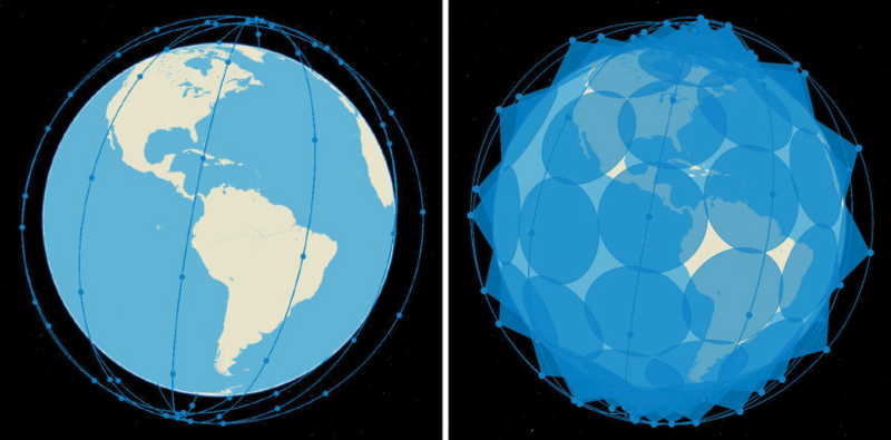
Satellite Constellation coverage. Image extracted from the report by the Congressional Budget Office on "Large Constellations of Low-Altitude Satellites: A Primer" https://www.cbo.gov/publication/59175.
Extracted on Oct 8 2024
File history
Click on a date/time to view the file as it appeared at that time.
| Date/Time | Thumbnail | Dimensions | User | Comment | |
|---|---|---|---|---|---|
| current | 22:35, 8 October 2024 |  | 825 × 407 (304 KB) | Vsahay (talk | contribs) | Satellite Constellation coverage. Image extracted from the report by the Congressional Budget Office on "Large Constellations of Low-Altitude Satellites: A Primer" https://www.cbo.gov/publication/59175. Extracted on Oct 8 2024 |
You cannot overwrite this file.
File usage
The following page uses this file: